OpenStreetMapping My Neighborhood
Sep 01 2007 Sat
6:10 pm PHT
Ever since I discovered that the OpenStreetMap (OSM) project expanded their coverage to the whole world, I was excited to map out my neighborhood since I saw that my area is still virgin territory yet untouched by Philippine-based OSM contributors. You can actually add data on the site itself using their Potlatch web app. It’s a slick Adobe Flash-based application that provides a rudimentary, yet powerful map data editor and can directly show Yahoo! Maps satellite imagery for tracing streets. The other popular way of adding data is via the JOSM Java-based desktop application. JOSM is intended for power users and serious OSM contributors.
Since I don’t want to install Java 1.5 on my laptop, I’ve been contributing using the Potlatch editor. While I can’t add much metadata (like which streets are one-way), Potlatch is a really decent editor for creating, classifying and naming new streets, which I have been doing.
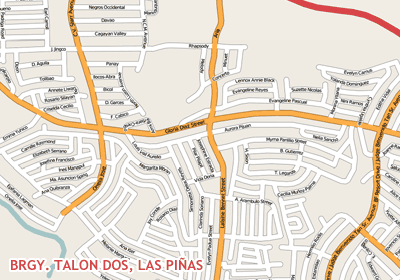
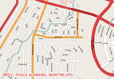
So far, I’ve already mapped parts of my neighborhood in Las Piñas and some areas in Alabang. You can see Mapnik renderings of my progress scattered in this blog post. (The images are released under the CC-BY-SA 2.0 license.)
This goes to show that I’m a really geeky person. Being an active contributor to Wikipedia is already geeky enough. Contributing street-level maps to OSM is even geekier.

For other examples of beautiful street maps created using OSM data, check out their featured images wiki page.
Comments
Comments are currently disabled.